Red Line Trail Study
The Red Line Trail Study, launched in 2023, is a crucial step towards the long-term vision for Red Line Trail in Central Texas.
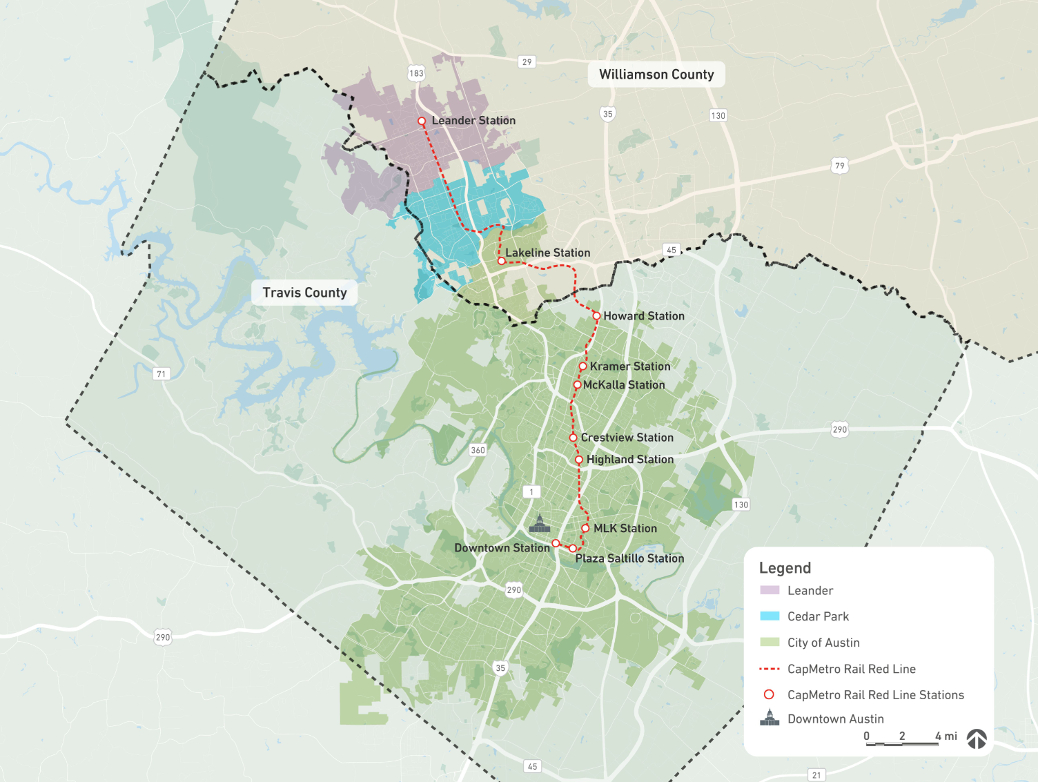
Originating in 2004 with CapMetro’s voter-approved All Systems Go Plan, the Red Line Trail is envisioned as a 32mile corridor that generally follows the Red Line commuter and freight rail corridor through Austin, Cedar Park, and Leander. For nearly two decades, regional partners have worked towards implementing this active transportation corridor that provides critical first and last mile connections to the regional transit system. The study aims to provide a consistent and clear path forward for delivering the trail with our partners in the region.
CapMetro approaches this study, and the Red Line Trail, with our commitment to multi-modal, environmentally responsible, transportation solutions for Central Texas. We recognize that the most beneficial role CapMetro can play in delivering the trail is by providing access to, and usage of, our existing right-of-way, where possible, to help facilitate the realization of this project for the region. While CapMetro owns the rail right-of-way; and would be glad to provide access for partners who focus on trail construction to build and maintain the trail segments, the agency cannot deliver this project for the community alone.
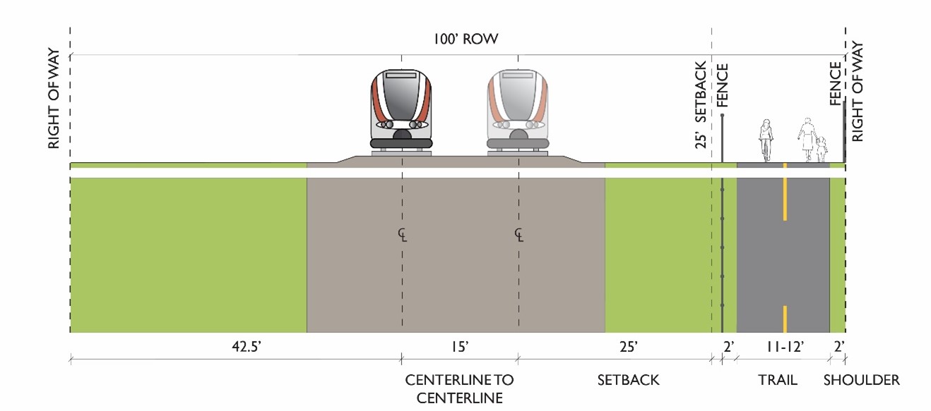
The study identifies feasible opportunities and recommendations for incorporating the Red Line Trail within CapMetro’s rail right-of-way. It evaluates the corridor by analyzing each trail segment’s opportunities and constraints. Additionally, the study outlines guidelines that support safe multimodal connectivity, and establishes processes that clarify how implementing partners can work closely with us to design, engineer and construct the trail.


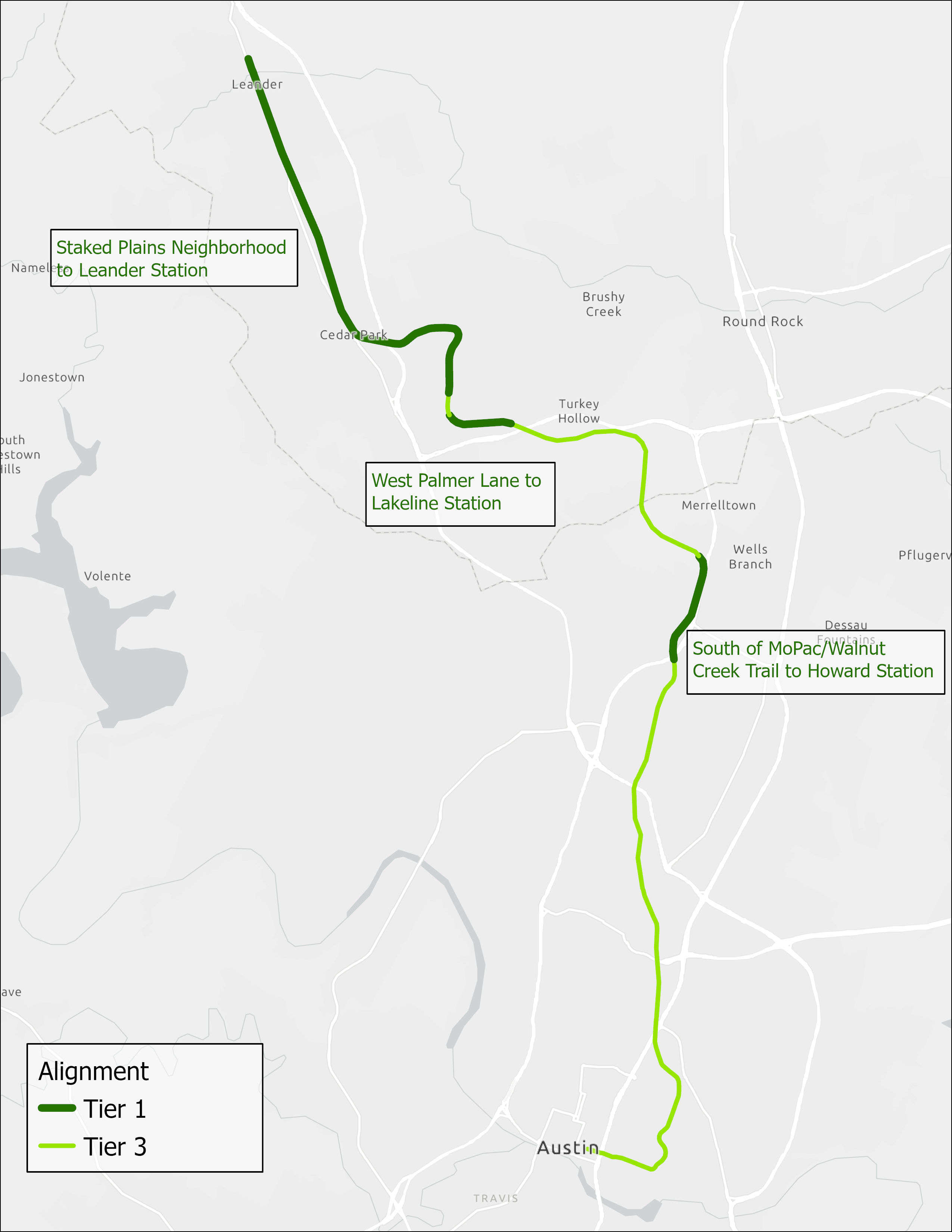
The analysis identified that approximately 40% of the 32-mile corridor can safely accommodate the trail along with rail operations and future operational expansion of the rail without requiring variances. This includes segments totaling 13.07 miles, from south of MoPac/Walnut Creek Trail to Howard Station, West Palmer Lane to Lakeline Station, and Staked Plains Neighborhood to Leander Station.
The remaining 60% of the corridor requires close work with implementing partners to make location-specific adjustments that safely accommodate rail operations and bike and pedestrian access. Through similar partnerships, several segments on this portion of the Red Line Trail currently have existing bike infrastructure, totaling 5.7 miles. Those segments with existing bike infrastructure were analyzed for potential relocation to or expansion within the rail right-of-way.
The opportunities outlined in the study serve as a guide for possibilities within the rail right-of-way and provide a critical path forward. The study is not meant to predict the final design or placement of a potential future trail. Regional partners will implement the vision, in collaboration with CapMetro. Timing and implementation of the trail depends on available funding, constructability, and the complexity of each segment. CapMetro will continue championing the Red Line Trail, through provision of rail right-of-way access and usage, and will work collaboratively with our implementing partners to deliver an integrated trail for the community. The following report summarizes the key efforts and findings from the Red Line Trail Study.
Resources
Red Line Trail Study - Trail Alignment Possibilities
Explore our Open Houses
Proposing a Trail Project within CapMetro Rail Right-of-Way
The documents below can assist you through the process, guidelines and next steps.
Design Guidelines & Standard Operating Procedures
For more information and key contacts, please visit our Rail Right of Way page.